Our Services
Using a drone may seem daunting at first, but it actually offers Australian farmers and commercial industries a precise, efficient, and cost-effective way to manage crops or industry assets. Drones can access hard-to-reach areas, don’t damage paddocks after rain; apply pesticides, fertilisers, or seeds with pinpoint accuracy, and can adjust spray rates based on real-time conditions or requirements. This reduces chemical use, minimises waste, and ensures even coverage across varied terrain. Our surveying drones can collect accurate real-time data with our specialist Multispectral, Photographic or Light Detection and Ranging (LiDAR) equipment, allowing farmers to maximise yield and industry to plan and monitor major projects.Additionally, drones save time and labour; allowing us to cover large areas quickly, while also being more environmentally friendly by reducing aircraft or heavy machinery use, whilst simultaneously reducing the chance of run-off and over spray. 
Agricultural Application
Using AAD for chemical and fertiliser application can lower costs by reducing pesticide usage and increasing crop yields through precise and efficient targeting Aerial applications. Some major benefits are:Major cost savings: Pesticides will have two application rates, Aerial and Ground, Aerial rates are typically 1/3 to 1/4 of the Ground rate, saving you thousands of Dollars in pesticide usage! eg. Glyphosate has an Aerial rate of 30L per HA and a ground rate of 150L per HA.Time and Labour Savings: Drones can cover large areas quickly, reducing the time and labour required for applying pesticides, fertilisers, and seeds. One Drone can cover up to 20 Hectare per hour depending on the application rate.
Precision Application: Ensures targeted application of chemicals and fertilisers, minimising waste and lowering input costs by avoiding over-application. Our drones have a spray swath of 6m-11m ensuring a wide application for broadacre or small for spot spraying.Improved Crop Health: Spot treatments with drones allow for addressing specific problem areas, whilst spreading cover crop after harvest restores the soils fertility, leading to healthier crops and potentially higher yields.Access to Difficult Terrain: Drones can easily navigate challenging landscapes, ensuring even coverage across all areas of your farm.Soil Preservation: Eliminates the need for heavy machinery, reducing soil compaction and promoting long-term soil health.Environmental Benefits: More precise application reduces the risk of chemical run-off, contributing to more sustainable farming practices and minimising your exposure to carcinogenic chemicals.

Agricultural Surveying
Our drones equipped with multispectral sensors help identify crop health issues early, allowing targeted interventions that improve yields and reduce input costs. Some other major benefits are: Crop Health Monitoring: Multispectral drones capture different wavelengths of light to detect plant stress and disease early, enabling timely interventions.Efficient Resource Use: Identify areas needing specific treatments, allowing you to optimise the use of water, fertilisers, and pesticides, reducing costs and environmental impact.Improved Yield Estimates: Accurate data helps you predict crop yields more reliably, aiding in better planning and management.Targeted Management: Provides detailed imagery for precision farming, helping you apply resources only where they are needed, improving overall farm efficiency.Enhanced Decision-Making: Data-driven insights enable better decisions regarding planting, irrigation, and crop management strategies.Time Savings: Quick, comprehensive surveys cover large areas efficiently, saving you time compared to traditional methods.


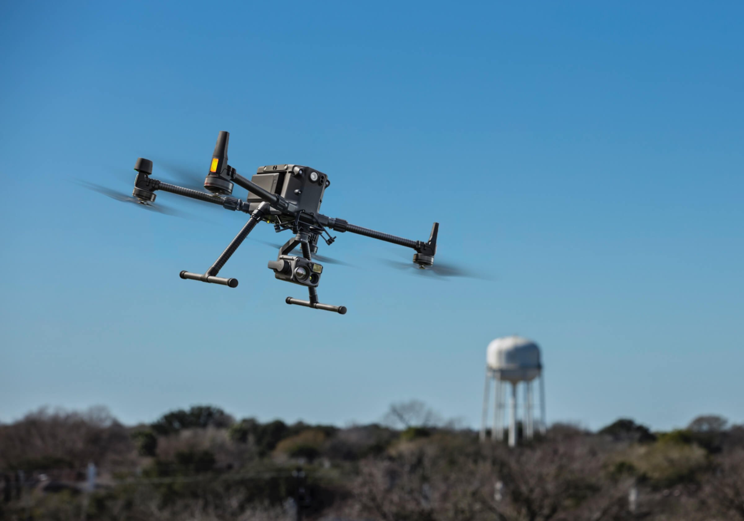
Industrial Surveying
Our drones enhance industrial surveying by providing faster, more accurate data collection, improving decision-making, and reducing operational costs and safety risks. Some other major benefits are:High-Resolution Data Collection: Photographic drones provide detailed, high-resolution imagery for accurate mapping and analysis of large areas.3D Modelling and Mapping: LiDAR drones create precise 3D models and topographic maps, aiding in detailed site analysis and planning.Efficient Surveying: Rapid data collection over extensive areas reduces time and labour compared to traditional methods.Improved Accuracy: LiDAR technology offers precise measurements of elevation and distance, enhancing the accuracy of surveys.Enhanced Decision-Making: Detailed visual and spatial data supports better planning, risk assessment, and decision-making for projects.Cost Savings: Reduces the need for manual surveys and lowers overall project costs by streamlining data collection and analysis processes.Access to Hard-to-Reach Areas: Drones can survey difficult or hazardous locations safely and effectively, minimising risk to personnel.
Additional Services
Our specialist drones can assist you and your company with a multitude of task across a vast spectrum of roles. Some of these additional services are:Insurance Assessments: We can facilitate aerial inspections for insurance claims, providing detailed imagery to assess damage, provide evidence or verify claims.Infrastructure Inspection: We can inspect critical infrastructure such as power lines, bridges, and buildings, detecting damage visually, with thermal or LiDAR cameras.Search and Rescue: Our drones equipped with thermal cameras can aid in locating missing persons and assessing disaster areas in any weather condition.Security and Surveillance: Our drones can be deployed for perimeter security, crowd monitoring, and general surveillance, leveraging our advanced camera systems and laser range finders.Firefighting Support: We can assist in wildfire management and urban firefighting by providing thermal imaging to locate hotspots and assess fire spread.Environmental Monitoring: We can assist in tracking changes in environmental conditions, monitor wildlife, and supports conservation efforts through aerial surveys.
Sales and Servicing
We offer a wide range of after sales, customer and technical support from our qualified Aircraft Maintenance Engineering team. Some of these additional services are:After purchase of a new drone you’ll receive: 1 day of setup, training and FREE delivery for customers within 200km of Brisbane1 FREE Annual or 100 Hrly maintenance service (less parts) from a qualified Aircraft Maintenance EngineerFREE 24/7 phone customer support
Additional services we offer are: Drone Maintenance and OverhaulsIn person Technical and customer supportWritten-off Drone purchasingConsignment salesDrone Trade-Ins with a new purchase
We provide aerial imagery, 3D mapping, and data collection using drones, we are not licensed Surveyors. Our services are for informational purposes only and should be used in conjunction with professional Surveyors not as a substitute for professional Surveying. For certified Surveyor services or expert opinions, please consult a qualified Surveyor, Engineer or Agronomist with our aerial images.